How to find us
Use your Sat Nav or believe Google Maps if you must, but be prepared to be sent on many a wild goose chase on very narrow roads – Google refuses to admit that one of the key roads exists! Much better to follow the directions below.
This page also gives up to date information about any local road closures or known delays which could affect your journey.
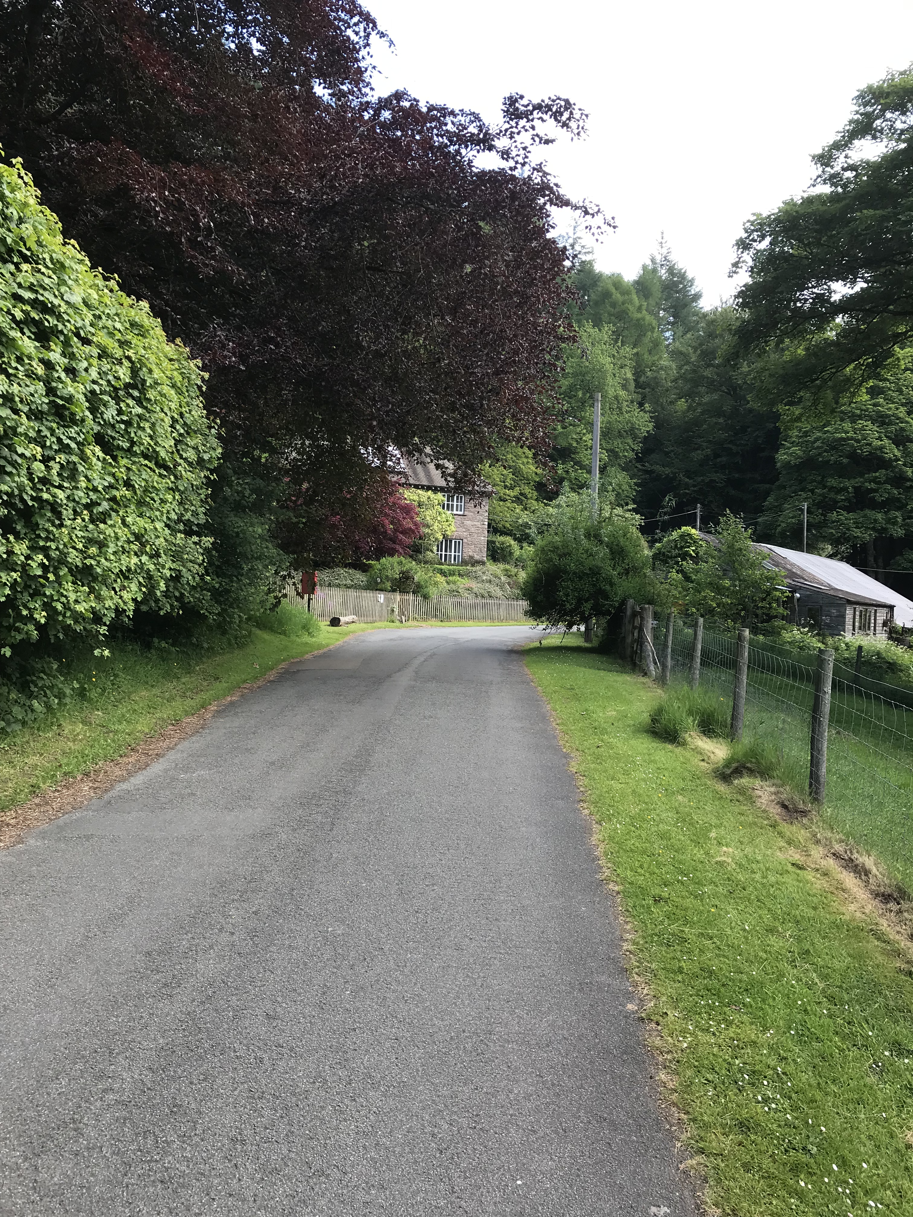
This is the view when you have arrived.
If you prefer to turn round before parking, please do so using our yard. If we are not there just open the gates, turn and close the gates. Please do not turn in the gateways of our neighbours up the road. Please do not park on the verge beyond our yard gates as it is dark and the road is narrow and occasional large farm traffic could remove your door mirrors!
If planning a group visit by coach or minibus use only the route via Llanfihangel Crucorney. If you don’t, you might find yourself like this.
Nant y Bedd is to be found 4.5 miles up the road towards the Grwyne Fawr Reservoir, in the area known as Fforest Coal Pit, Abergavenny. It is a Dead End road, a 5 mile long Dead End!
Please do not follow these directions if you have not booked your tickets. We do not like to disappoint potential visitors who have not booked.
For those who still use proper OS maps the grid reference is SO 25705 26869.
If you trust more modern methods, you can get here using library.skies.model on What3Words
We are about equidistant from Abergavenny and Crickhowell, both around 10 miles away.
From ABERGAVENNY or HEREFORD areas take the A465 Abergavenny to Hereford road and turn off into LLANFIHANGEL CRUCORNEY.
By the Skirrid Inn (in Llanfihangel Crucorney) turn down the hill (following signs for Llanthony), bear left at the bottom of the hill and continue for about a mile, passing under a railway bridge (13’6″ height limit). Turn left at the signpost for Fforest Coal Pit, Partrishow and Llanbedr. This is the road which Google Maps doesn’t think exists.
After a mile and a half you will arrive at Five Ways junction. Take the road to the Grwyne Fawr Reservoir, passing the (Grade II listed) grey telephone box and continue over the river for 4.5 miles.
From CRICKHOWELL, turn up by the Fire Station and initially follow signs to Llanbedr. Do not turn into Llanbedr, but follow signs to Fforest Coal Pit (sometimes just Fforest). There is also a red edged sign to Grwyne Fawr at one junction (just past a large house called Craig y Bwla), follow this one not the Grwyne Fawr **** on the bigger fingerpost. You will come to ‘the house in the middle of the road’. Bear left and left again down the hill and you will come to Five Ways Junction. Take the road to the Grwyne Fawr Reservoir, passing the (Grade II listed) grey telephone box and continue over the river for 4.5 miles.
Please note that this route is currently not possible due to a landslip. If you are confident on narrow roads and reversing in tight places you can take the following diversion when you reach ****. Go straight on and keep right when the road splits. At the t-junction turn right down the hill and over a small bridge. You have now reached Five Ways. We will continue to check on this obstruction / diversion with Powys County Council, and advise if and when anything changes. If you are not happy with narrow roads etc. the from Crickhowell continue to Abergavenny and follow the directions above.
Travelling from HAY on WYE it is probably easiest to approach from the Crickhowell direction via Talgarth. However see above about the possible road closure. The direct route is via the Llanthony valley which is very narrow in places and can be very congested in Summer.
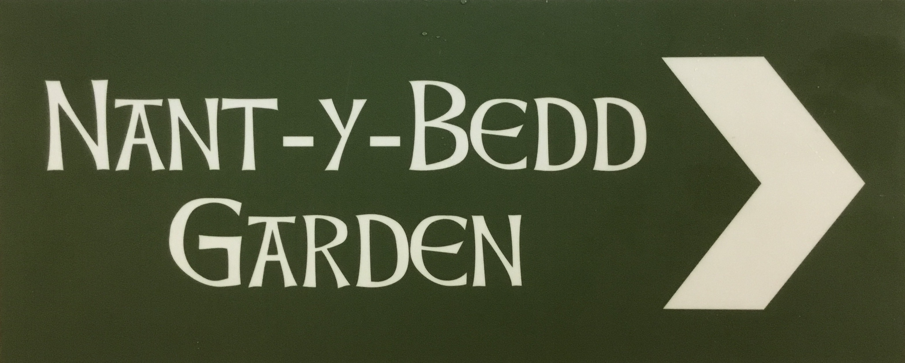
It really is only 4.5 miles from Five Ways to Nant y Bedd, but will seem further if you are not familiar with the area. Don’t give up! Keep an eye open for these small signs at strategic points.
The house is on the left hand side next to a small red Post Box. Please park on the right hand side alongside the black roofed barn. See picture above – and maybe print it off and bring it with you! Lots of people do!! Ian will know, as soon as you get out of your car, if you have followed these directions or trusted your sat nav!!
If you insist on using your Sat Nav, it will probably tell you you have arrived opposite a house called Ty Hir. Keep going for another half a mile and you will be at Nant y Bedd.
Finally, we realise that many of our lovely visitors are not used to the narrower roads around here. This generally leads to driving more slowly. However, you should please realise that residents and regular users of the roads are likely to want to proceed a bit more rapidly. There are plenty of places where you can pull over and allow faster vehicles through. It is not only polite, but also saves you worrying about another vehicle trying to get up your exhaust pipe! We don’t want you arriving ‘all of a tizz’.
In common with many roads across the country, we have our fair share of potholes. We have been making strong representations to Powys County Council, and things are slowly improving, but please do keep your eyes peeled.

